Maritime Navigational Charts
Looking for Maritime Navigational Charts?
Maritime Navigational Charts
Antiques
Maritime
Art
Collectibles
Militaria
Original Period Items
Central America/Caribbean Maps
Maps, Atlases & Globes
Art Posters
Documents & Maps
United States
WW II (1939-45)
North America Maps
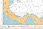
4402 North Atlantic Ocean Caribbean Sea Chart Map Maritime Marine Wall Admiralty
more Details
USD 47.00
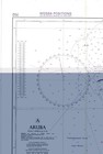
702 Aruba Curacao Caribbean Sea Nederlandse Antillen Chart Map Marine Admiralty
more Details
USD 47.00
Vintage St. Johns River May 1965 Nautical Chart 636-sc Maps
more Details
USD 20.00
1639 Florida Coast Historic Vintage Style Wall Map - 24x32
more Details
USD 24.95
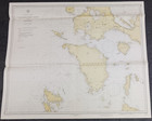
1841 Map Tuamotu Group 4 Islands S. Pacific Hydrographic U.s.ex.ex.
more Details
USD 20.00
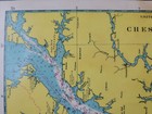
Vintage Nautical Map Chesapeake Bay Maryland Mercator Projection
more Details
USD 19.95
1981 Noaa Key West To The Mississippi River Soundings Chart, Sailor Used 36 X 44
more Details
USD 19.99
1936/43 Luzon Mindoro Philippine Islands 34"x41" Map U.s.c.-g.s. Color Wwii
more Details
USD 20.00
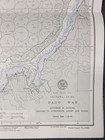
1945 Japan Okinawa Shima Nago Wan 22"x17" Map Hydrographic Restricted
more Details
USD 20.00
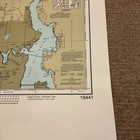
Noaa Chart 18441 Puget Sound - Northern Part
more Details
USD 25.99
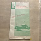
Intracoastal Waterway Pilot Infomation #670 Norfolk Va To Key West Fl May 1945
more Details
USD 34.97
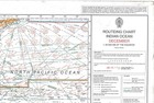
5126 12 Routeing Chart Indian Ocean December Chart Map Maritime Wall Admiralty
more Details
USD 47.00
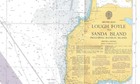
2798 British Isles Lough Foyle Sanda Island Rathlin Isalnd Chart Map Admiralty
more Details
USD 47.00
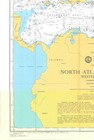
4013 North Atlantic Ocean Western Part Chart Map Maritime Marine Paper Admiralty
more Details
USD 47.00
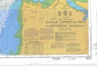
Admiralty 2622 Inner Approaches To Mumbai India West Coast Chart Map Marine Wall
more Details
USD 47.00
1936 California Coast San Diego To Descanso Pt. 46"x36" Map Hydrographic Navy
more Details
USD 20.00
1923 Washington Bellingham Bay 29"x24" Map Hydrographic Restricted Anchorage
more Details
USD 20.00
1914 Washington Roche Harbor San Juan Island Spieden 39"x34" Map U.s.c.-g.s.
more Details
USD 20.00
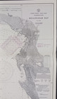
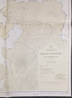
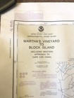
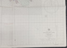
Noaa Nautical Training Chart 1210 Tr Martha's Vineyard To Block Island Look 1985
more Details
USD 29.99
1945 China East Coast Kou-ch'i Shan Area 30"x40" Map Hydrographic Restricted
more Details
USD 20.00
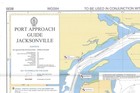
8030 Port Approach Guide Jacksonville Chart Map Maritime Marine Paper Admiralty
more Details
USD 47.00
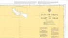
Admiralty 2858 Gulf Of Oman To Shatt Al Arab Chart Map Wall Marine Maritime
more Details
USD 47.00
1892 Nautical Chart ~ Breakwaters Of Lake Champlain - Cross Sections
more Details
USD 18.00
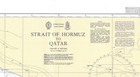
Admiralty 2837 Strait Of Hormuz To Qatar Chart Map Maritime Marine Wall Nautical
more Details
USD 47.00
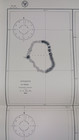
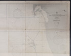
Antique Nautical Star Chart - Louis Weule Co. / Capt. D.h. Bernard; Early 20th C
more Details
USD 225.00
Vintage Noaa Nautical Chart Nautical Map Lot (6)vintage Waterway Map Lot 88’-89’
more Details
USD 12.00
Vtg Nautical Map Chart Great Lakes Lake Huron St Mary's 14882 1991 36x48"
more Details
USD 11.75
Vtg Nautical Map Chart Gulf Coast Cape St George Miss. 11360 1979 44x36"
more Details
USD 11.75
Ocracoke Inlet North Carolina Print Pamlico Sound 1882 Coast Survey
more Details
USD 55.00
1936 Japan 46"x33" Map Nansei Shoto Islands Japanese Surveys 1933 Heavy Stain
more Details
USD 15.00
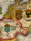
Sea Chart Of Europe 1583 Vintage Style Navigational Map - 18x24
more Details
USD 13.95
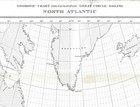
5095 North Atlantic Gnomonic Chart Facilitating Great Circle Sailing Chart Map
more Details
USD 49.00
Handcrafted Irish Blackthorn Walking Stick Traditional Knob Handle Cane Shille
more Details
USD 199.50
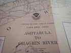
Vtg Nautical Map Chart Great Lakes Ashtabula Chagrin Rvr 14825 1985 30x42"
more Details
USD 11.75
U.s. Dept Commerce Nautical Chart 826-sc Little Egg Harbor To Cape May Nj 1971
more Details
USD 5.00
Vtg Noaa Nautical Map Chart Ny Niagra River Welland Canal 14822 1992 44x29"
more Details
USD 11.75
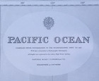
1993 Pacific Ocean 2683 Admiralty Nautical Map Chart 40x41
more Details
USD 59.99
Vintage Navigational Condition Report Chart Kieler Forde Germany Nautical Chart
more Details
USD 13.30
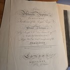
Barre Publishing Edition The Atlantic Neptune 1966 Vol 1 Chart Map New England
more Details
USD 999.99
Store of Sound
Motors
Business & Industrial
Pet Supplies
Antigues
Babys
Toys & Hobbies
Clothing, Shoes, Accessories
Vehicles & Accessories
Sports Mem, Cards
Cameras & Photo
Cell Phones & Accessories
Collectibles
Consumer Electronics
Sporting Goods
DVDs & Movies
Video Games & Consoles
Home & Garden
Computers/Tablets
Musical Instruments
Jewelry & Watches
Books
Everything Else
Health & Beauty
RELATED PRODUCTS
Specials
Vintage Nautical Chart Harbor Noaa
Coast Nautical Chart
Chart Coast Nautical
Vintage Noaa Nautical Chart River
Noaa Nautical Chart Coast Bay
Nautical Chart Map
Vintage Nautical Chart Navy Hydrographic
Vintage Hydrographic Map Nautical Chart
Vintage 1959 Navigational Chart
Nautical Chart Antique 34x23 Massachusetts Barnstable Harbor Vintage
Cape Cod Bay Nautical Chart Vintage Antique
Vintage Circa 1950 Usc gs Chart Map
Antique 1882 East India Archipelago Nautical Chart Map
Vintage Yachtsman Northwest Chart
329 Portsmouth Harbor Antique Nautical Chart
Vintage Chas C Hutchinson Nautical
Shop
Vehicles/Acess.
Cell Phones
Tablets/Comp.
Musical Instr.
Professional Audio
Bass
Percussion
DJ Equipamnent
Guitars/Basses
Acoustic
SEARCH
Home
(current)
Motors
Business & Industrial
Pet Supplies
Antigues
Babys
Toys & Hobbies
Clothing, Shoes, Accessories
Vehicles & Accessories
Sports Mem, Cards
Cameras & Photo
Cell Phones & Accessories
Collectibles
Consumer Electronics
Sporting Goods
DVDs & Movies
Video Games & Consoles
Home & Garden
Computers/Tablets
Musical Instruments
Jewelry & Watches
Books
Everything Else
Health & Beauty