Coast Nautical Chart
Looking for Coast Nautical Chart?
Art Prints
US
Transportation
Maps
Antiques
Art Posters
Books & Magazines
North America Maps
Other Fishing Equipment
Fishing
Canada
International
Textbooks, Education & Reference
Home Décor
Art
Collectibles
Maps & Atlases
Maritime Navigational Charts
Maritime
Antiquarian & Collectible
Books
Maps, Atlases & Globes
Sporting Goods
Fishing Equipment
Souvenirs & Travel Memorabilia
Maps & Atlases
Posters & Prints
Home & Garden
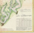
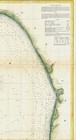
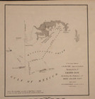
1867 Nautical Chart Coast Coastal Survey Map Puget Sound Washington Wall Poster
more Details
USD 37.95
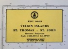
Vintage 1968 Map - Us Coast & Geodetic Survey Nautical Chart St Thomas St John
more Details
USD 24.99
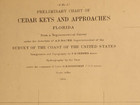
1854 Nautical Chart U.s. Coast Survey Preliminary Chart, Cedar Keys & Approaches
more Details
USD 18.00
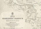
1866 Charleston Harbor U.s. Coast Survey Chart Coastal Nautical Map Wall Poster
more Details
USD 37.95
1857 Nautical Chart Us Coast Coastal Survey Map Decor Monterey Bay California
more Details
USD 21.95
1803 Nautical Chart Coast Coastal Survey Map Baltic Sea Vintage History Poster
more Details
USD 21.95
Chesapeake Bay Entrance Nautical Chart Map Vintage Virginia 1992 Mariners Coast
more Details
USD 19.00
1837 U.s. Nautical Chart Atlantic And Gulf Coast Wall Poster Survey Coastal Map
more Details
USD 19.95
1854 Nautical Chart - Louisiana Coast - Pass Fourchon ~ (9x12)-#05
more Details
USD 18.00
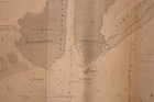
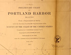
1854 Nautical Map / Chart, U.s. Coast Survey ~ Preliminary Chart Portland Harbor
more Details
USD 18.00
1853 Nautical Chart Coast Survey Map Decor Key Biscayne Bay West Cedar Florida
more Details
USD 21.95
United States Coast Pilot 7 Pacific Coast 1959 Hb Nautical Chart Guide
more Details
USD 20.00
1979 Noaa Nautical Chart Map #17300 Alaska-southeast Coast Stephens Passage
more Details
USD 29.99
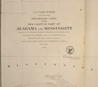
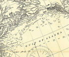
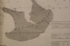
1856 Nautical Chart ~ Sea Coast Of Pert Of Alabama & Mississippi (22x29)-#28
more Details
USD 18.00
1898 U.s. Coast And Geodetic Survey Map Of Alaska Chart Coastal Nautical Poster
more Details
USD 37.95
1855 U.s. Coast Survey, Florida Panhandle Chart Coastal Map Nautical Wall Poster
more Details
USD 27.95
1857 Nautical Chart - Mississippi Coast - Grand Island Pass ~ (11x16)-#06
more Details
USD 18.00
1851 Nautical Chart Mississippi Coast - Grand Bay - Horn Island Pass (8x8)-#10
more Details
USD 18.00
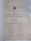
Nautical Chart Map 13307 East Coast Maine Camden Rockport Rockland Harbors
more Details
USD 34.99
Imray M47 Nautical Chart Aeolian Islands Italy West Coast 2010 Rod Heikell
more Details
USD 18.99
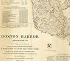
1857 Boston Harbor Mass. Us Coast Survey Chart Coastal Nautical Map Wall Poster
more Details
USD 21.95
1853 Chart U. S. Coast Survey ~ Cape Charles & Vicinity ~ A. D. Bache
more Details
USD 18.00
1859 Nautical Chart Coast Survey Map Art Decor St George Sound Florida Panhandle
more Details
USD 21.95
1856 Nautical Chart ~ Jacksonville - Florida & South Carolina Coast (25x38)-#15
more Details
USD 18.00
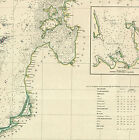
1828 Map Ne Coast North America, N.y. To Cape Canso Nautical Chart Wall Poster
more Details
USD 37.95
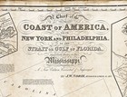
1800 Chart N. American Coast Between Cape Cod And Havanna Coastal Map Nautical
more Details
USD 19.95
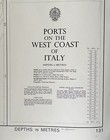
Vintage Ports West Coast Italy Nautical Chart Map - 42” X 28”
more Details
USD 29.00
Vtg Nautical Map Chart Gulf Coast Cape St George Miss. 11360 1979 44x36"
more Details
USD 11.75
1820 U.s. East Coast Survey Chart Coastal Map Nautical Wall Poster Home School
more Details
USD 69.95
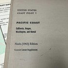
1963 U.s. Coast Pilot 7 Pacific Coast 9th Ed + 1967 Nautical Chart Catalog No. 2
more Details
USD 9.85
Coast & Geodetic Survey Nautical Chart Manual 6th Edition 1963 Original Binder
more Details
USD 114.99
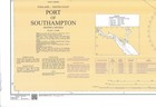
2041 England South Coast Port Of Southampton Chart Map Marine Maritime Admiralty
more Details
USD 79.00
Texas Gulf Coast Sportfishing And Nautical Chart Package Great Savings On 9 Char
more Details
USD 169.00
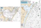
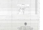
Admiralty 2891 Us East Coast Cape Cod Canal And Approaches Chart Map Marine Wall
more Details
USD 79.00
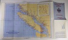
1968 Canadian Nautical Charts Southern British Columbia Coast Vtg Maritime Ships
more Details
USD 15.99
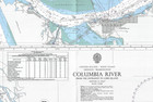
2839 Columbia River Us West Coast Oregon Washington Chart Map Marine Admiralty
more Details
USD 79.00
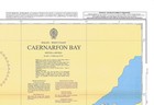
1970 Wales West Coast Caernarfon Bay Chart Map Maritime Nautical Wall Admiralty
more Details
USD 79.00
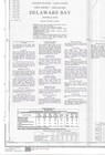
2564 Us East Coast New Jersey Delaware Bay Chart Map Marine Wall Paper Admiralty
more Details
USD 79.00
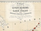
1884 Map Nautical Chart Showing Lighthouses Of The Usa Lake Coast Poster Print
more Details
USD 13.95
Store of Sound
Motors
Business & Industrial
Pet Supplies
Antigues
Babys
Toys & Hobbies
Clothing, Shoes, Accessories
Vehicles & Accessories
Sports Mem, Cards
Cameras & Photo
Cell Phones & Accessories
Collectibles
Consumer Electronics
Sporting Goods
DVDs & Movies
Video Games & Consoles
Home & Garden
Computers/Tablets
Musical Instruments
Jewelry & Watches
Books
Everything Else
Health & Beauty
RELATED PRODUCTS
Specials
Vintage Nautical Chart Harbor Noaa
Coast Nautical Chart
Chart Coast Nautical
Vintage Noaa Nautical Chart River
Noaa Nautical Chart Coast Bay
Nautical Chart Map
Vintage Nautical Chart Navy Hydrographic
Vintage Hydrographic Map Nautical Chart
Vintage 1959 Navigational Chart
Nautical Chart Antique 34x23 Massachusetts Barnstable Harbor Vintage
Cape Cod Bay Nautical Chart Vintage Antique
Vintage Circa 1950 Usc gs Chart Map
Antique 1882 East India Archipelago Nautical Chart Map
Vintage Yachtsman Northwest Chart
329 Portsmouth Harbor Antique Nautical Chart
Vintage Chas C Hutchinson Nautical
Shop
Vehicles/Acess.
Cell Phones
Tablets/Comp.
Musical Instr.
Professional Audio
Bass
Percussion
DJ Equipamnent
Guitars/Basses
Acoustic
SEARCH
Home
(current)
Motors
Business & Industrial
Pet Supplies
Antigues
Babys
Toys & Hobbies
Clothing, Shoes, Accessories
Vehicles & Accessories
Sports Mem, Cards
Cameras & Photo
Cell Phones & Accessories
Collectibles
Consumer Electronics
Sporting Goods
DVDs & Movies
Video Games & Consoles
Home & Garden
Computers/Tablets
Musical Instruments
Jewelry & Watches
Books
Everything Else
Health & Beauty